James Cook in the Southern Ocean or The "Carte de l'Hémisphère Austral
In the series "Archive of the Month", the German Maritime Museum (DSM) / Leibniz Institute of Maritime History presents a special treasure from the archive every month. In March, shortly before the beginning of spring, DSM staff member Dr. Frederic Theis looks back about 250 years: In the spring of 1773, James Cook (1728-1779) led his ship RESOLUTION through the Southern Ocean, crossing the Southern Arctic Circle (66°33'S) for the first time.
The expedition through ocean and drift ice was aimed at Terra Australis Incognita, a presumed giant southern continent. The accompanying map of 58.5 by 59.3 cm shows an image of the southern hemisphere, in which South America, Africa, Southeast Asia, Australia ("Nouvelle Hollande") and New Zealand are inscribed. Cook's travel route from 1772 to 1775 is highlighted in bold strokes, on which he reached the southernmost point ever at 71°10'S on February 3, 1774. In addition, the coordinates of numerous newly surveyed islands and capes appear in the map corners. The French map sheet goes back to an English original, with which it is largely identical in form and content. If the English version had illustrated James Cook's travel report "A Voyage towards the South Pole" of 1777, the French translation published in 1780 in the "Histoire Générale des Voyages", now from the workshop of the engraver Robert Bénard, testifies to the interest in the South Pole region also on the European continent.
Cook had neither seen nor set foot on the Antarctic mainland. And so his map did not reveal anything about the coastline of the southern continent, but left its depiction to future explorers.
Contact
Thomas Joppig
Overview archives of the month
Archive of the Month: Treasure from the Archive
Archive of the Month in January: From New York to Bremen 1859
Archive of the month for February: Photos of the small cruiser MEDUSA
Archive of the month in April: The engine journal of the Bremen icebreaker DONAR
Archive of the Month in May: The Diary of Caroline von Aschen
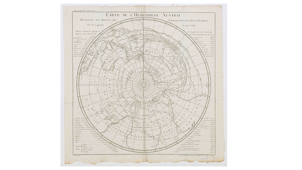
French edition of the "Carte de l’Hémisphère Austral" aus der "Histoire Générale des Voyages", Paris 1780. Archiv DSM, Sign. I 2 VI 53. Credit: DSM
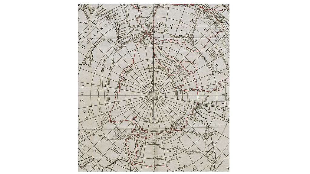
Map section with James Cook's expedition route (highlighted in red): Three times the southern polar circle was crossed "CERCLE ANTARCTIQUE" southward. Credit: DSM
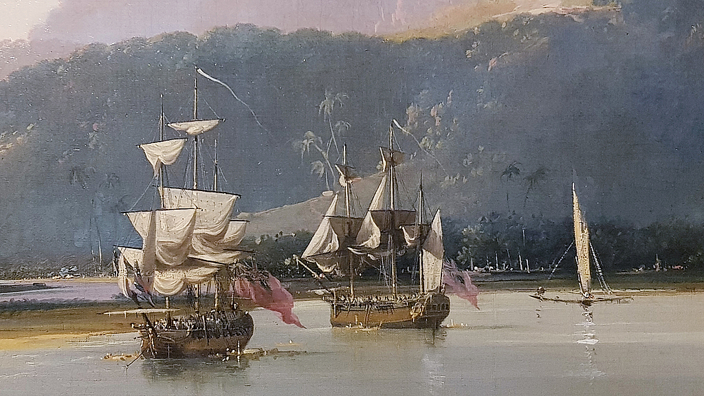
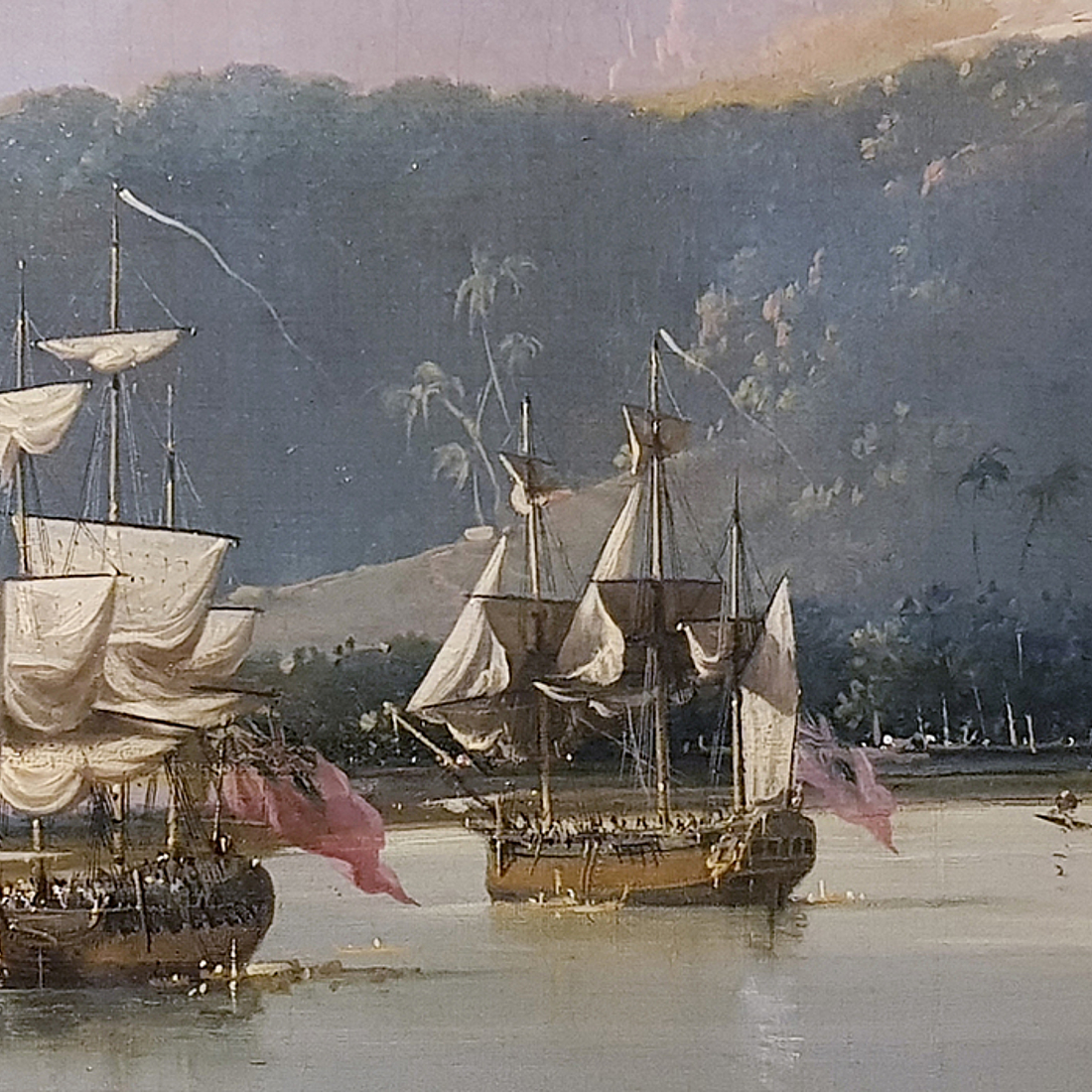
James Cook's ship RESOLUTION (left) in Matavai Bay, Tahiti, South Seas. Detail from a painting by William Hodges, 1777, National Maritime Museum, Greenwich. Foto: Frederic Theis