KARTEN WISSEN MEER - Globalization from the water: Insights into the measurement of the oceans
What types of nautical and marine charts were and are there? How were they made and used? What stories are associated with the surveying of the oceans and their depiction in maps? The special exhibition "KARTEN WISSEN MEER - Globalization from the Water" at the German Maritime Museum / Leibniz Institute for Maritime History invites visitors to unravel sea charts of the past, to look over the shoulders of seafarers, scientists and shipowners of the 19th century, to leaf through a ship's diary or to create travel routes themselves.
From Europe to America in two seconds, circumnavigating the globe and grasping the dimensions of the Pacific - it's all possible, with your finger on the sea chart or on the globe. Sea and ocean charts awaken the desire to decipher details, but they also show the big picture. Just how much can be gleaned from them is revealed by the special exhibition KARTEN WISSEN MEER, which will be on display at the German Maritime Museum (DSM) / Leibniz Institute of Maritime History from February 25 to April 24, 2022.
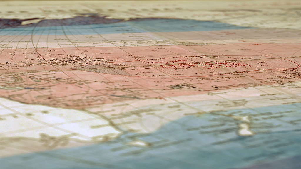
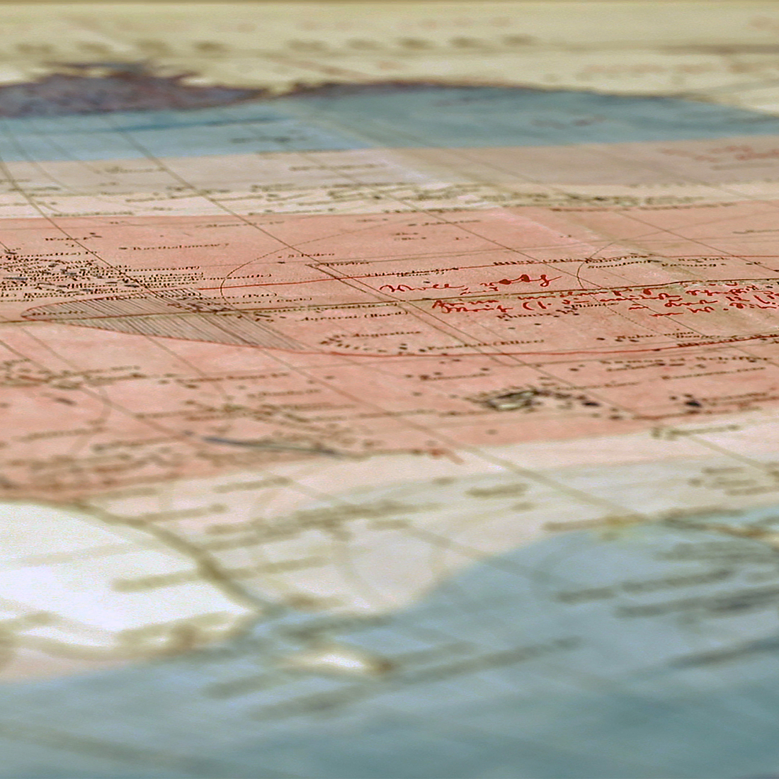
Museum guests will find five themed islands in the exhibition and explore both the diversity of maritime maps and the methods and processes by which maps were produced and used. While 17th- and 18th-century marine charts were often colorful works of art, sometimes showing islands that did not (or did not) exist, over the course of the 19th century the sheets increasingly transformed into sober media of marine science, depicting wind, current, and depth conditions at sea, oceanographic features, or the navigation marks laid out for the purpose of safe navigation.
On display are 63 analog and digital reproductions of historical marine charts from the collection of the German Maritime Museum and the Perthes Gotha Collection; also other chart-related objects such as ship models, historical navigation instruments such as sextants, lead sounders or chronometers, as well as explanatory books and graphics that focus on the people of the past.
Thus, on the one hand, the marine charts of the 19th century had a distinctly practical function in that they provided useful information to captains, cartographers or shipowners. But soon the circle of users expanded. The "Chart of the World" of 1871, for example, an affordable map of the world's oceans that could be folded up into a handy little package, was no longer intended exclusively for seamen or scientists, but also and especially for people with a more private interest in the sea. Global networking across the seas is vividly depicted here. Thus, in general, maps popularized and democratized knowledge about the ocean, depicted transport connections, and thus made the sea a controllable space in people's perception, an area even suitable for leisure activities such as sailing competitions or cruises.
KARTEN WISSEN MEER also spreads a growing travel fever: visitors:inside can delve into transoceanic voyages next to the maps in an old timetable, leaf through a sea atlas or inspect colorful posters that advertised recreational trips. At a multimedia station, visitors are invited to draw various maps themselves. And it doesn't stop there. After all, who hasn't always wanted to navigate a sailing ship on a safe route from Europe to South America? Interested visitors can take on this task at the map table 'Sailing on the South Atlantic'.
The special exhibition is a joint project of the German Maritime Museum, the Gotha Research Center, the Perthes Gotha Collection and the Universities of Erfurt and Bremen. It is supported by the Federal Ministry of Education and Research, the Leibniz Action Plan and the Friends of the DSM.
KARTEN WISSEN MEER will be on view at the DSM from February 25 to April 24, 2022.
Tickets for guided tours can be booked at www.dsm.museum/ticket.
Access to the exhibition
The special exhibition INTO THE ICE is located in the extension building of the DSM. As the building is due to be renovated in the near future, visits to the exhibition will take place exclusively in the form of accompanied tours or themed tours, which will allow all guests to visit the exhibition safely. Until July 31, 2022, guided tours will be offered on Thursdays, Saturdays, and Sundays, with a maximum of 25 visitors per tour. During vacation weeks and on public holidays, there are daily appointments. Tickets can be booked in advance at www.dsm.museum/ticket, remaining tickets are available at the Kogge-Halle box office half an hour before the start of the respective date.
There are two variants:
- On the accompanying tours, museum guests explore the exhibition independently along a predefined route accompanied by a guest advisor.
- In the case of themed tours (in German), curators and experts guide guests to selected stations and exhibits in the exhibition on the basis of a content-related concept. These dates can also be found in the calendar of events. All other dates that are not listed there but can still be booked via the ticket store are guided tours.
Each guided tour or visit lasts one hour. Admission is 6 euros, concessions 3 euros.
Book your ticket now.
Please note that the exhibition can only be visited via an accompanied tour or a themed tour. In the program overview for March (in German) all guided tours and accompanied visits are listed.